Main Topics

Extended Abstract Submission

Registration Accommodation

PROGRAM
08:30 - 11:00 Registration
11:00 – 11:30 Welcome Ceremony
11:30 - 12:15 Welcome and Keynote Speech I
Chairperson: Orhan Altan
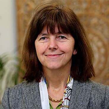
GeoAI – Chances and Challenges
Speaker: Sester, Monika
12:15 - 13:30 Lunch
13:30 - 14:45 Technical Session I — Remote Sensing Applications in Hazard Monitoring and Management
Chairperson: Marco Scaioni
  • OP-01 Influence of Geological and Geomorphological Factors on Vertical Co-Seismic Deformation Induced by the Mw 7.2 Al Haouz Earthquake (Morocco, 2023) Habib, Adnane; El Adnani, Ayoub; Berrada, Ilyasse; Najih, Amine; Fadili, Ahmed; Laaziz, Youness Ahmed; Arrad, Taha Youness; Lagnaoui, Abdelouahed
  • OP-02 Integration of Remote Sensing Data in Rain-on-Grid Flood Modelling and Post-Event Validation Using Orthophotos Akpınar, M. Berkay; Akyürek, Zuhal
  • OP-03 Mapping Post-Rainfall Recovery in Arid Regions Using a Hierarchical U-Net Hong, Xin
  • OP-04 Spatiotemporal Evaluation of Pre-Seismic Deformation Patterns: The Case of Northern Thessaly, Greece Eskandari, Rasoul; Biparvayekhiabani, Seyedmohammadmahdi; Genzano, Nicola; Castiglioni, Carlo Andrea; Scaioni, Marco
Exhibition
14:45 - 15:30 Poster Presentations I
  • PP-01 GeoTopo-Net: A GIS-Based Framework for Automated Topology Recognition and Equipment Grouping in Power Distribution Networks Deniz, Oğuz; Tekin, Elif Rana; Arslan, Süha Nur
  • PP-02 Climate Hazard Assessment for Dairy Farming in Aydin, Türkiye: Preliminary Results from the CliResDairy Project Karaman, Çağrı; Cerit, Hediye; Demirkol, Mehmet Kemal; Koç, Engin; Kiper, Elif İrem Köse; Çukurlu, Göktuğ Yaşar; Demir, Nusret
  • PP-03 Assessing Mangrove Ecosystem Health and Identifying Optimal Planting Regions Using Remote Sensing and GIS in the UAE Ben Salem, Imen; Annamalai, Karthi
  • PP-04 Mapping Social Vulnerability Through Accessibility Patterns: The Istanbul Case Terzi, Aydın Furkan; Aksu, Koray; Koçyiğit, Ayşenur; Demirel, Hande
  • PP-05 Overview of the Top-Level Design and Practice of the ReS3D China Xue, Chao
  • PP-06 Assessing Urban Flooding and Vegetation Impact in Dubai Creek Following the April 2024 Extreme Rainfall Alhammadi, Dana; Hong, Xin
  • PP-07 Mapping Urban Vegetation Changes Using PlanetScope Imagery and GIS: A Case Study of the 2024 Dubai Flood Almansoori, Sumayya; Hong, Xin
  • PP-08 GIS-Based Morphometric Terrain Analysis for Watershed Characterization: Case Study of Ain Leuh Watershed, Morocco El Mhamdi, Akif; Habib, Adnane; Tajdi, Amina; Aarab, Mohammed
  • PP-09 No-Code GIS for Big Spatial Data: A Platform for Interactive Logistics Visualization Sarı, Sefa; Kabil, Ali Osman; Kamaşak, Mustafa E.
  • PP-10 Pixel-Based Classification of Olive Trees Using Multi-Spectral UAV Images and Vegetation Indices Kemal, Rabia; Afanyalı, Mine; Baharoğlu, Zeren; Eryavuz, İpek; Atik, Muhammed Enes; Atik, Şaziye Özge
  • PP-11 Law of Sines Based Approach for the Accurate Orientation Determination Kaya, Merve; Doğan, Nezir; Bettemir, Önder Halis
  • PP-12 Deep Learning-Driven Wildfire Detection in Türkiye Using Sentinel-2 Imagery and Convolutional Neural Networks Mohamed, Mahmoud; Şahin, Sefa; Oumate, Mahamat Oumar; Karaş, İsmail Rakıp; Sevinç, Hacer Kübra
  • PP-13 Wildfire Susceptibility Mapping in Karabük Province, Turkey Using Machine Learning Algorithms Yılmaz, Melih; Dönmez, Ahmet Serdar; Afana, Osama; Abujayyab, Sohaib K. M.; Sevinç, Hacer Kübra; Açmalı, Şüheda Semih; Karaş, İsmail Rakip
  • PP-14 Metaverse-Enabled Digital Twins for Business and Smart Cities: Toward a Human-Centered Framework for Digital Transformation Qudaih, Rasem; Caldwell, Nicholas; Ben Salem, Imen; Karthi, Annamalai
15:30 - 16:45 Technical Session II — SAR and InSAR Applications in Earth Observation
Chairperson: Saygın Abdikan
  • OP-05 Explainable Artificial Intelligence in Forecasting MT-InSAR Based Time Series Surface Movements Yagmur Aydin, Nur; Erten, Esra; Taskin, Gulsen; Musaoglu, Nebiye
  • OP-06 Overcoming Optical Gaps: Evaluating SAR–Optical Consistency for Cotton Phenology Demirci, Alp Eren Furkan; Sunar, Filiz
  • OP-07 AI-Based Framework for Rapid Extraction of InSAR Coherence from COMET-LiCSAR Portal Çukurlu, Göktuğ Yaşar; Veziro, Furkan; Demir, Nusret
  • OP-08 Monitoring of Surface Deformations in Geothermal Areas Using the InSAR Method: A Case Study from Denizli, Türkiye Polat, Ahmet Batuhan; Akcay, Ozgun; Avsar, Emin Ozgur
  • OP-09 InSAR Time-Series Analysis of Surface Motions Caused by the 2023 Kahramanmaraş Earthquake in Hatay, Türkiye Coskun, Suat; Bayik, Caglar; Abdikan, Saygin; Gorum, Tolga; Balik Sanli, Fusun
16:45 - 17:00 Coffee Break
17:00 - 18:15 Technical Session III — Applied Geospatial Analysis and Modelling
Chairperson: Andrea Masiero
  • OP-10 Age Matters: Demographic-based Perceptions of Included Location Information Sutton, Dominick; Polat Kayali, Merve; Basiri, Anahid
  • OP-11 Road Maintenance Prioritization (RMP) System Afana, Osama; Saghir, Mewloud; Karaş, İsmail Rakıp; Abujayyab, Sohaib K. M.
  • OP-12 An Automated Data Validation Approach for Power Distribution Networks using Grid Partitioning and Multi-faceted Quality Scoring Deniz, Oğuz; Arslan, Süha Nur
  • OP-13 Data Classification on the Geoid Surface with Grey Wolf Optimization Kirici Yildirim, Ulku; Sisman, Yasemin
  • OP-14 Influence of Vegetation Period on Personal Laser Scanning Accuracy for Tree Attribute Estimation in Pedunculate Oak and European Beech Forests Kokeza, Andro; Medak, Damir; Domazetović, Fran; Marić, Ivan; Šiljeg, Ante; Seitz, Albert; Balenović, Ivan
19:30 - 21:30 Welcome Reception
09:00 - 10:15 Technical Session IV — GeoAI and Urban Spatial Analysis
Chairperson: Maria Antonia Brovelli
  • OP-15 GeoAI Applications in Smart Cities: A Systematic Review on Transportation, Building Models, and Navigation Sevinç, Hacer Kübra; Demiral, Emrullah; Açmalı, Şüheda Semih; Karaş, İsmail Rakıp
  • OP-16 Assessment of Industrial Areas in Terms of Plan Sustainability through GIS and AHP Integration: The Case of Trabzon Terzi, Fatih; Atasoy, Bura Adem; Uzun, Bayram; Yıldırım, Volkan; Aslan, Furkan; Uzun, Semih
  • OP-17 Development of a Land Vehicle and Data Acquisition System for Building Audit Doğan, Nezir; Şengül, Ayşe Nur; Uzunkaya, Ali; Kaya, Merve; Bettemir, Önder Halis
  • OP-18 Advancing Building Footprint Extraction with Multi-Stage Regularization Techniques Emelyanov, Anton Vladimirovich; Knyaz, Vladimir Alexandrovich; Kniaz, Vladimir Vladimirovich
  • OP-19 A Stacking Ensemble Technique to Predict Signal Path Loss via 3D GIS Perihanoglu, Güzide Miray; Karaman, Himmet; Akgül, Tayfun
Exhibition
10:15 - 11:00 Poster Presentations II
  • PP-01 GeoTopo-Net: A GIS-Based Framework for Automated Topology Recognition and Equipment Grouping in Power Distribution Networks Deniz, Oğuz; Arslan, Süha Nur; Tekin, Elif Rana
  • PP-02 Climate Hazard Assessment for Dairy Farming in Aydin, Türkiye: Preliminary Results from the CliResDairy Project Karaman, Çağrı; Cerit, Hediye; Demirkol, Mehmet Kemal; Koç, Engin; Kiper, Elif İrem Köse; Çukurlu, Göktuğ Yaşar; Demir, Nusret
  • PP-03 Assessing Mangrove Health and Identifying Optimal Planting Regions Using Remote Sensing and GIS in The UAE Ben Salem, Imen; Annamalai, Karthi
  • PP-04 Mapping Social Vulnerability Through Accessibility Patterns: The Istanbul Case Terzi, Aydın Furkan; Koçyiğit, Ayşenur; Aksu, Koray; Demirel, Hande
  • PP-05 Overview of the Top-Level Design and Practice of the ReS3D China Xue, Chao
  • PP-06 Assessing Urban Flooding and Vegetation Impact in Dubai Creek Following the April 2024 Extreme Rainfall Alhammadi, Dana; Hong, Xin
  • PP-07 Mapping Urban Vegetation Changes Using PlanetScope Imagery and GIS: A Case Study of the 2024 Dubai Flood Almansoori, Sumayya; Hong, Xin
  • PP-08 GIS-Based Morphometric Terrain Analysis for Watershed Characterization: Case Study of Ain Leuh Watershed, Morocco El Mhamdi, Akif; Habib, Adnane; Tajdi, Amina; Aarab, Mohammed
  • PP-09 No-Code GIS for Big Spatial Data: A Platform for Interactive Logistics Visualization Kabil, Ali Osman; Sarı, Sefa; Köse, Ümit; Kamaşak, Mustafa E.
  • PP-10 Pixel-Based Classification of Olive Trees Using Multi-Spectral UAV Images and Vegetation Indices Kemal, Rabia; Afanyalı, Mine; Baharoğlu, Zeren; Eryavuz, İpek; Atik, Muhammed Enes; Atik, Şaziye Özge
  • PP-11 Law of Sines Based Approach for the Accurate Orientation Determination Kaya, Merve; Doğan, Nezir; Bettemir, Önder Halis
  • PP-12 Deep Learning-Driven Wildfire Detection in Türkiye Using Sentinel-2 Imagery and Convolutional Neural Networks Mohamed, Mahmoud; Şahin, Sefa; Oumate, Mahamat Oumar; Karaş, İsmail Rakıp; Sevinç, Hacer Kübra
  • PP-13 Wildfire Susceptibility Mapping in Karabük Province, Turkey Using Machine Learning Algorithms Yılmaz, Melih; Dönmez, Ahmet Serdar; Abujayyab, Sohaib K. M.; Karaş, İsmail Rakip; Afana, Osama
  • PP-14 Metaverse-Enabled Digital Twins for Business and Smart Cities: Toward a Human-Centered Framework for Digital Transformation Qudaih, Rasem; Caldwell, Nicholas; Ben Salem, Imen; Karthi, Annamalai
11:00 - 11:45 Keynote Speech II
Chairperson: Özgün Akçay
A Digital Twin of the Terrestrial Water Cycle: The Remote Sensing Perspective
Speaker: Wagner, Wolfgang
11:45 - 13:00 Lunch
13:00 - 14:15 Technical Session V — Geospatial AI and Machine Learning Applications in Remote Sensing
Chairperson: Fabio Remondino
  • OP-20 CNN-Based Downscaling of Land Surface Temperature and Scaling Effect Analysis Using Multi-Sensor Satellite Data: A Case Study in L’Aquila, Italy Ali, Kamran; Clementini, Eliseo; Patrizi, Roberto; Santic, Marco; Villante, Carlo
  • OP-21 A Comparative Study of Nature-Inspired Optimization Techniques for MLP-Based Sentinel-2 Image Segmentation Yeğin, Abdullah Furkan; Karaş, İsmail Rakıp; Abujayyab, Sohaib
  • OP-22 Towards Annotation-Less Semantic Segmentation of Aerial Point Clouds Alami, Ashkan; Remondino, Fabio
  • OP-23 Advances in Stereo Matching for Disparity Estimation from Satellite Imagery: Traditional Scanline Aggregation Methods versus Deep Learning-Based RAFTStereo Sayın, Yazgı Nur; Ok, Ali Özgün
  • OP-24 Detection of Hazelnut Orchards with Sentinel-2 imagery and machine learning classification algorithms Sengul, Gafur Semi; Tumer, Ilay Nur; Sertel, Elif; Ustaoglu, Beyza
14:15 - 14:30 Coffee Break
14:30 - 15:45 Technical Session VI — Remote Sensing for Atmospheric Pollution and Environmental Monitoring
Chairperson: Filiz Sunar
  • OP-25 Satellite-Based Assessment of NH3 and CH4 Levels around Biogas Facilities in Izmir Bayram, Sedef; Aydın, Merve; Alban, Aykut Mehmet; Saracoglu, Serra; Kaynak, Burcak
  • OP-26 Estimating Ground-Level Carbon Monoxide Concentrations Using Machine Learning Techniques: The Metropolitan City of Milan Case Study Liang, Zhongyou; Cedeno Jimenez, Jesus Rodrigo; Yordanov, Vasil; Brovelli, Maria Antonia
  • OP-27 Analyzing the Role of Topography in NO₂ Dispersion: Evidence from the 2021 Manavgat Forest Fire Atalay, Hatice; Sunar, Filiz; Dervişoğlu, Adalet
  • OP-28 Investigating the Role of Geographic Information Systems in Advancing Positive Energy Districts Koçyiğit, Ayşenur; Aksu, Koray; Terzi, Aydın Furkan; Demirel, Hande
  • OP-29 Investigation of NH3 Concentrations around Livestock Farms in Balıkesir and Bursa Tokgoz, Seda; Metin, Oykü; Alban, Aykut Mehmet; Saracoglu, Serra; Kaynak, Burcak
15:45 - 16:00 Coffee Break
16:00 - 17:15 Technical Session VII — Mobile Mapping, SLAM, and Visualization
Chairperson: Ali Özgün Ok
  • OP-30 Update and Quality Assessment of GeoDBs in Urban Areas Based on SLAM Technology Genzano, Nicola; Scaioni, Marco
  • OP-31 Spatio-Temporal Detection and Filtering of Dynamic Objects in Mobile LiDAR Point Clouds Zeybek, Mustafa
  • OP-32 A Digital Layer of Memory: 3D Documentation, Art Historical Interpretation, and Web-Based Presentation of the Saint Michael Church Atasoy, Bura Adem; Akın, Alper Tunga; Terzi, Fatih; Yuka, Ahmet
  • OP-33 The accuracy analysis of the Visual-SLAM and LiDAR-SLAM methods: A case study Özbayrak, Simla; Basaran, Aleyna; Kaya, Emirhan; Uçarlı, Ahmet Can; İlçi, Veli
  • OP-34 Generative Inpainting of Partially Destroyed Frescos Kniaz, Vladimir V.; Moshkantsev, Petr; Bordodymov, Artem; Knyaz, Vladimir A.
09:00 - 10:15 Technical Session VIII — Geospatial AI and Remote Sensing Applications
Chairperson: Fusun Balık Şanlı
  • OP-35 Evaluating the Accuracy of Pedunculate Oak Tree Volume Estimates Using Static Terrestrial and Mobile Personal Laser Scanning Seitz, Albert; Indir, Krunoslav; Kokeza, Andro; Balenović, Ivan
  • OP-36 Multi-Temporal Tree Species Classification using Sentinel-2 Imagery and Machine Learning: A Case Study from Bolu, Aladağ Forests Aksut, Arif; Kuter, Semih
  • OP-37 Synthetic and Real Data for Training and Testing Ground Camera-Based UAV Tracking Masiero, Andrea; Dabove, Paolo; Di Pietra, Vincenzo; Piragnolo, Marco; Guarnieri, Alberto; Vettore, Antonio; Toth, Charles
  • OP-38 Behavioural Analysis of Segmentation Accuracy Metrics on Synthetic Urban Objects Avşar, Emin Özgür; Akçay, Özgün; Polat, Ahmet Batuhan
  • OP-39 Multi-scale scene graph generation for remote sensing imagery Knyaz, Vladimir A.; Kniaz, Vladimir V.; Emelyanov, Anton V.
Exhibition
10:15 - 10:30 Coffee Break
10:30 - 11:45 Technical Session IX — Earth Observation for Climate Dynamics and Environmental Sustainability
Chairperson: Zafer Aslan
  • OP-40 Enhancing Climate Variable Prediction through Wavelet-Machine Learning Integration and Remote Sensing Data Dwikat, Abdallah; Aslan, Zafer
  • OP-41 The Impact of Climate Change on Wildfire Dynamics and Forest Ecosystems: A Focus on the Aegean Region Yılmaz, Hüseyin Onur; Sabuncu, Aslı
  • OP-42 Next-Generation Snow Cover Monitoring in Near Real Time: Evaluating the EUMETSAT H SAF H43 Product from MTG-FCI across the European Alps Kuter, Semih; Karaman, Çağrı Hasan; Akpınar, Mustafa Berkay; Akyürek, Zuhal
  • OP-43 From Mesh to Meaning: 3D Models and VR for Knowledge Sharing in Landscape Restoration Gabriele, Marzia
  • OP-44 Harnessing EO and Natural Experiments for Urban Development: The UDENE Approach Yordanov, Vasil; Oxoli, Daniele; Obrenović, Nikola; Pejak, Branislav; Lenk, Onur; Musaoğlu, Nebiye; Kapukaya, Bekir; Erbay, Yücel; Kara, Seda Nur; İpek, T. Yücel; Rahji, Mohamed; El Fadhel, Ahmed; Souissi, Syrine; Özbayoglu, Murat; Pekkan, Hüseyin; Deniz, Oğuz; Türker, Ali; Tomić, Marina Carević; Brovelli, Maria Antonia
11:45 - 12:30 Lunch
12:30 - 13:15 Trip to Troy
13:15 - 15:45 Visit the Troy Museum and the Archaeological Site of Troy
15:45 - 16:30 Trip to Çanakkale

KEYNOTE SPEAKERS